Aerial Documentation Case Study: Remington Shot Tower, Bridgeport, Connecticut
- Rui Pinho

- Apr 13, 2020
- 2 min read
Updated: Feb 14
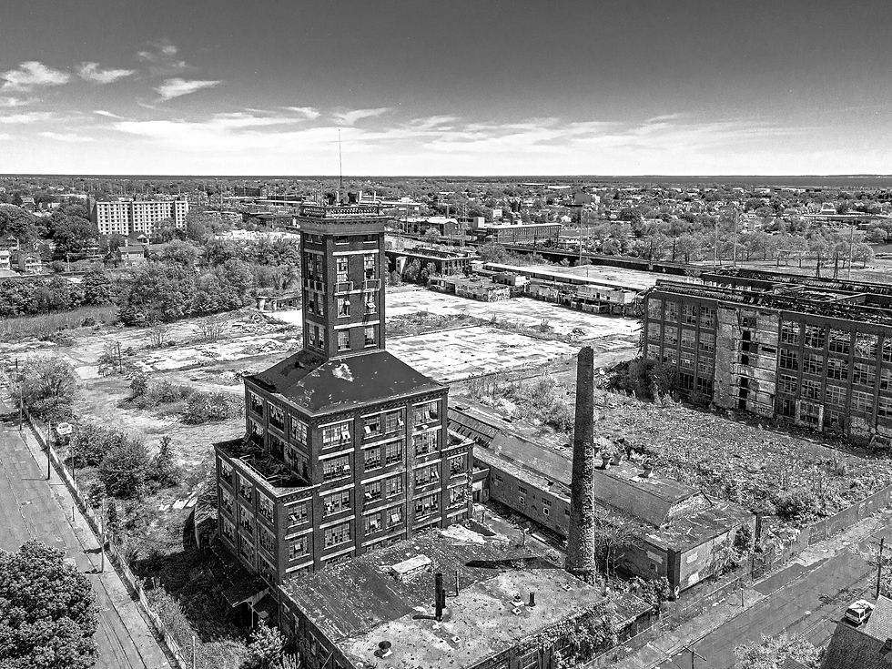
The Remington Shot Tower stands as one of Bridgeport’s most recognizable industrial landmarks.

The Bridgeport Shot Tower (Remington-UMC) was completed in 1909 and is one of a small number of surviving shot towers. Constructed in the late 19th century, the tower was used in the production of lead shot for ammunition. Molten lead was poured from the top of the structure, forming near-perfect spheres as it cooled during its descent. The height of the tower was functional engineering, not ornament.
Today, the structure remains a visible marker of Bridgeport’s industrial past and its broader manufacturing history.
Remington Shot Tower Aerial Documentation for Preservation and Planning

This independent documentation was structured as a small preservation-ready package, demonstrating how a historic asset can be recorded for institutional use.
The focus was on:
Exterior condition at time of capture
Geographic and neighborhood context
Structural scale and vertical prominence
Clean, stabilized aerial perspectives
The goal was clarity first, with slightly cinematic framing used only to enhance legibility and spatial understanding.
All aerial capture was conducted under FAA Part 107 certification.
Deliverable Structure

The documentation set was organized as a small archival package suitable for:
Preservation grant support
Planning and zoning review
Historic commission reference
Long-term institutional records
Files were labeled and grouped by:
Establishing context views
Architectural elevation perspectives
Wide neighborhood relationship imagery
High-resolution archive masters and optimized presentation files
Even at a small scale, structure matters. Clear labeling and organization determine whether documentation remains useful beyond the moment it is captured.
Why Aerial Documentation Matters for Historic Assets
Historic industrial structures often sit within evolving urban environments. Ground photography can record detail, but aerial context clarifies:
Relationship to adjacent development
Proximity to transportation infrastructure
Waterfront or environmental positioning
Overall footprint and spatial impact
For grant writers and review boards, context is not decorative. It supports funding narratives and planning justification.
The Remington Shot Tower is one example of how a single structure can represent an entire chapter of regional history. Organized visual documentation ensures that record remains usable over time.

If your organization is preparing a preservation application, capital improvement proposal, or historic documentation initiative, I’m open to discussing an approach that produces clear, organized deliverables your team can retain and reference.
For details, Get in Touch.


Comments